TRUSTED BY DEVELOPERS
Plotviewer Features
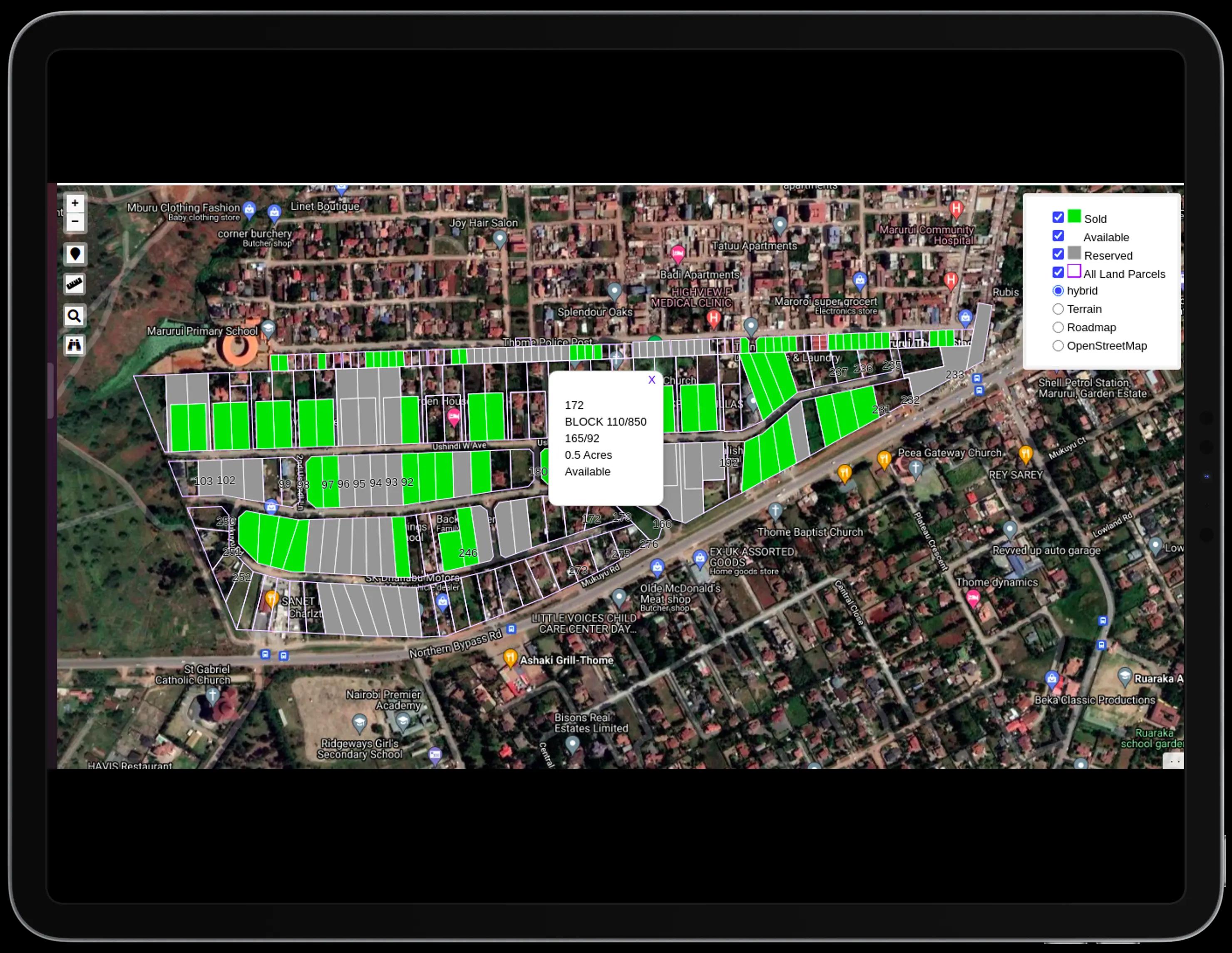
A web application that seamlessly fuses subdivision maps with interactive mapping and VR technology to virtually transport property seekers to the property location on the map

Survey Data on Map
We overlay parcel boundaries (mutation drawing) on the base map and list details of the parcels in a pop-up. This is data from the title deed, the official search, the RIM and Mutation Drawing.
- Parcel boundaries
- Title deed details
- Mutation Drawing overlay

Aerial & Ground Virtual Tours
These are complementary products to view the land in better resolution and see the amenities and services available.
- High-resolution virtual tours
- Amenities overview
What Plotviewer Can Do for You
There is the amount of money changing hands during this transaction, then there is The Value.

Directions
A user can use the direction button on the pop up that links directly to their Google Maps application on their phone to navigate to the parcel on the ground and possibly do an individual site visit

Share & Embed
A user can share the whole project or a single parcel by using the share button and sending the copied link on Whatsapp Messenger, on email etc


